THE GRANDADDY BASIN and the ENERGY FORMULA CONFIRMED
On my FACEBOOK page I posted earlier today the following:
The "ACID TEST" and "ENERGY" -- For those interested, I did survive the "acid test" in the High Uintas and learned a lot. I'll get a report up on the website by late evening, but if you want more "ENERGY" why wait for the details--just go to my article on the subject and get the stuff that works miracles at: GET THE ENERGY
Afterwards it seemed like what I was suggesting is done on that funny TV commercial about the great metal roof on a house the realtor was trying to sell, expounding enthusiastically how great, long lasting, fireproof, beautiful, etc. the roof was. She then asked, "Would you like to make an offer?" The buyers replied asking, "Could we see inside the house?" The salesman asked smilingly, "WHY?"
Here's the story about "why" you should maybe get the good "stuff," along with some good information about the Grandaddy Basin, or as me and buddies have termed it, "The Grandaddies." It is probably the highest traffic area in the Wilderness with the fishing in the lakes along the trail pretty slow, but yet is a most beautiful area worthy of your attention--and I'll clue you in to where the good fishing is too. First the overall view from up high on East Grandaddy Mountain on the southern rim of the basin. By the way that isn't me in the photo. I still have some hair! It is my buddy, Ted Packard, who went with me on one of my 3 trips to East Grandaddy Mt. to get this stunning view of "The Grandaddies."
As I describe the photographs that tell my 3 day, 16 mile backpacking experience, I'll point out some very important lessons learned, like, recognizing your limitations and paying heed to them. But let's get started with an overall view of the High Uintas, with an arrow pointing to the Grandaddy Basin, followed by a zoom in of the area:
To get to this area you drive east from the Wasatch Front to the town of Francis, 2 miles south of Kamas. At the 4 way stop you go due east towards "Woodland." That highway, SR-35, will take you up over Wolfcreek Pass and down to the North fork of the Duchesne River. After crossing the river you turn to the north up the canyon. For more detailed directions go to TO HADES and click on half a dozen photos. About 6 miles up the canyon you come to Defa's Dude Ranch you see next from the air.
Just past Defa's you turn off at the sign to the Grandview Trailhead (you can see clearly the turnoff on the previous Google Earth view). Along the way you get a view of the canyon and Lightning Ridge with the trail visible we used many years ago when we had to hike the 10 miles up to Hades Pass.
This was Thursday, June 24th and the road was in good condition. I got shots of several new wildflowers along the way. I will refrain from showing too many flowers in this photo essay, but below is a new one. About half a dozen of such photos will be added to my Wildflower albums.
Soon you pass Splash Dam Lake.
You continue to switch-back up the canyon and soon you are looking back at the Splash Dam Lake.
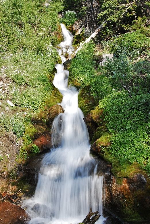
Just before arriving at the Trailhead you pass on your right a wonderful stream cascading down the mountains. I always stop to fill my water bladder. No need of purifying this wonderful water.
Soon you arrive at the Trailhead.
There were only 2 cars in the parking lot and only half a dozen entrees in the register.
Every visitor should review the Forest Service rules and regulations, one important one being that due to this being a high traffic area it is prohibited that any camp fire be within 1/4 mile of any lake. If you have a stove you can set up your camp 200 feet from lakes, streams, trails, or other camps. Of course Rule #1 is LEAVE NO TRACE!
I was ready with a pack weight of 25 lbs.--excluding my photo equipment. This included food for a 4th day if necessary. Contrary to what I said in my article about "A 3 Day Backpack" I put the pack hood back on as I needed that pouch for my extra photo equipment, the Iridium Satellite phone, and the SPOT Tracker--so all would be easily accessed. For details on my equipment and preparations go to: 3 DAY BACKPACK
I activated at the Trailhead my SPOT SATELLITE TRACKER, and then hit the message button again once at my destination, Fish Hatchery Lake. This sent the above Google Earth tracking to all interested. Of course my route was far from a straight line.
So I was on my way up the rocky trail you see below.
As I have advised all going into such a Wilderness, you have to be very cautious until you get your "mountain legs" working. It takes special concentration, balance, agility, and often quick reaction when a rock begins to move on you. It began to be obvious, likely due to now being in my 75th year, that my balance was off, as well as my agility. Special focus, and pretty quick reactions kept me moving safely up the trail.
Pretty soon you cross the Wilderness Boundary.
As usual the wildflowers in bloom attracted my attention--such as the two you see here, White Globeflower, and Marsh Marigold. The collection on my website now numbers 238 varieties.
Along the trail I was overtaken by Dr. Toby and a troop of Explorers from Heber, Utah.
They had several pack horses, and several riders--of course the leaders. All the hikers had backpacks. We'll run into them later on as they were heading for the same lake.
There was no snow on Hades Pass. A drift or two had been slogged through climbing to the pass, and then another patch a few hundred yards down into the Basin with the first view of Grandaddy Lake in view.
Grandaddy Lake is the largest lake in the High Uintas Wilderness. It was barren of fish in the days of the mountain men and pioneers, but thanks to the Fish and Game (Utah Department of Wildlife Resources) there are now fish in around 667 lakes--quite a few now with natural reproduction. Grandaddy Lake is one of them with the native cutthroat trout spawning from mid-June into July in the 3 streams that come into the lake on the western side, a few shots of which you see below.
Fishing is closed in these streams until July 7th.
More photographs of the spawn and info on fishing the Uintas at: FISHING
Fish Hatchery Lake was my objective for the first day--a distance of about 5.5 miles. The lake contains populations of both Eastern brook trout, and native cutthroat trout--that were spawning in the inlet stream as they were doing in Grandaddy.
Now to how I was doing. First it was clear that hiking with nearly a 40 lb. load (that included my photo equipment) at above 10,000 ft. on a very rocky trail is much different than jogging around the Reams Supermarket parking lot in Springville, Utah. I was quite fatigued with a sort of nauseous feeling that had me with no interest in eating, and even feeling as though I was sick. I went for water, purified it and mixed my Endurox with extra Glutamine, Gatorade, and Cal/Mag. I drank about 11 oz. using it to swallow my 2nd dosage of vitamins/minerals--all as outlined in my articles on ENERGY (scroll down) and GEAR/SUPPLEMENTS.
But, I had already drank the one drink that was delicious even when not feeling well: EGG NOG (12 oz. water, 2 dehydrated eggs, milk powder, sugar and cinnamon). Within an hour I felt well enough to go fishing and caught my dinner.
THE BIG NEWS THAT MADE THE TRIP A DELIGHT--NO MOSQUITOES YET! But the downside was that I couldn't enhance the nutrition of my Spanish Rice as the dandelions hadn't come out yet above 9,000 ft. I talk about them being "the spinach of the weed world" in my backpacking and other articles. For info go to DANDELIONS
The weather was great and warmer than usual, so my new sleep system--Golite Quilt, and Therm-a-Rest NeoAir mattress was almost too warm--stripping myself down to the barest essentials, but these two items more than met my expectations for being "the best."
To go along with my breakfast of Dee's Cereal, and Energy drink, I had cooked my omelet (with bacon bits) in the evening fire when doing my Spanish Rice and fish. I just mixed water in it's Ziploc bag forming a paste and then put it in aluminum foil to set in the fire for a few minutes.
I actually overcooked and browned it some but ate it the next morning using Ketchup and a Mild sauce from Arby's or Taco Bell.
It was a bit rubbery, and perhaps not at fault, but on eating breakfast I all of a sudden lost a tooth! Rather a crown that came loose. Luckily I didn't swallow it, and had to do a bit of repair work you see below.
In my GEAR/SUPPLEMENT section I talk about Plastic Surgery for repairs (scroll down about 1/3 of the article until you see the tube and the link where you can get it. It worked again--and is still working as I do this report--4 days later. Of course I cleaned it up, along with where it was to go, drying thoroughly and then stuck it in, holing it in place biting down on a wad of cotton for 30 minutes.
Hate to show my ugly teeth, but as you see I've got a complete mouth full--thanks to Plastic Surgery! By the way the glue itself is likely a powerful disinfectant and so all will go well, I hope. I'll report how it goes.
Wow--a mansion in the Wilderness! I'm approaching the Heber group to say hello and goodbye.
Here's Dr. Toby, an Emergency Room physician, one of the leaders of the group.
Here's the "Big Honcho" Scot Lythegoe. Then I was ready to head up the trail, Scot offering to take my portrait:
But before moving up the trail, let me pause to mention that throughout the Grandaddy Basin there are off trail lakes that offer real "wilderness experiences" and almost always far better fishing than in the lakes along the trails. From Fish Hatchery you can bushwhack your way to one of them climbing due west to the top of the saddle you see in the Lake's photo a few back. On that saddle is Farney Lake where you can catch Arctic Grayling. You see this beautiful lake below:
From Farney Lake, you can bushwhack your way to Sonny Lake I show below. Sonny has nice brook trout.
From Sonny Lake you hike around to its southern end and a 100 yards or so further you find Marsell Lake.
Below you see a pair of beautiful and quite large Native Cutthroat trout I caught here.
I should say that generally it is easier to get to Marsell Lake by coming up the trail towards Mohawk Lake from Betsy Lake. About 200 yards before Mohawk you head due north and come to a large pond and meadow area, work your way down to its upper end through the rocks, and then go west up the drainage until you find Marsell Lake. Use your topo map and compass and you'll find it and be richly rewarded.
Now let's head up the trail from Fish Hatchery Lake towards Pine Island Lake. I'll insert here the Google Earth image from my SPOT tracker messages to orient you as to where we are heading. These are the tracking views of my progress you can see by accessing the SPOT TRACKING website.
For this 2nd day I will loop up north then swing around back south and continue on back to Betsy Lake where I will set up my 2nd camp.
All along the trails I hike I take many photos of wildflowers, but to see most of them you'll have to go the Galleries section and scroll down: WILDFLOWER ALBUMS.
The trail leads you up to higher country, passing by one of many small lakes and ponds that generally don't have fish, and no name or number designation, such as the nice one seen below.
Below is seen one of the early bloomers in the High Uintas--Spring Beauty.
It is about a 1/4 inch across.
Then we come to Pine Island lake. My friend, Jeffrey Probst in his excellent Uinta guide book describes it as "the gem of the West fork of Rock Creek."
A few casts produced a few scrappy Eastern brook trout.
Pine Island panorama. Over the low saddle in the direct middle of this photograph is found Margo Lake. I had wanted to get to this lake, but it would have required a very rocky climb off-trail and to that point I was well aware that my balance was weak at best and decided that this limitation had to be heeded, especially as I was alone. Hate to admit it, but my "mountain legs" hadn't clicked in yet, and so had to back off a bit from my objectives. Let me mention that the best way to get to Margo Lake is following a trail from Pinto Lake accessed from the Highline Trail. At the northern tip of Pine Island, Lily Pad Lake is just to the right of the trail, and I stopped for a photo and a few casts.
You see on the left the lily pads just beginning to break the surface of the lake. Later it will be ringed with them, especially on the northern end.
Another Eastern brook trout grabbed my lure. During the entire trip I saw no fish surfacing. There weren't mosquitoes, but plenty of flies and other insects, so I'm not sure why I didn't see feeding fish.
Down the trail a 1/2 mile one comes to a cross-trail where the trail from Pinto and Governer Dern Lakes joins that trail south towards Palisades Lake. A rare sign mentioning an endangered toad has been posted.
I continued south dropping down quite a bit. In the moist areas the wildflowers continually caught my attention--here Spring Beauty and the Glacier Lily.
The Glacier lily is one of the early bloomers.


I arrived at an overlook high above Palisades Lake, but didn't get a photo as I thought I'd get to a better vantage point. My plan had been to squirt around its northern end and bushwhack southeast passing the tip of Lost lake and continuing on to Powell Lake. But, I could see that such an off-trail bushwhack would be through cliffs and very rocky areas interspersed with tons of downed timber. What with my ankle held together with screws, my titanium knee, and the problem I was experiencing with balance, once again I decided to take seriously my limitations and back off on my objectives. I just continued down the trail--but the trail became invisible at times. Only a horse had been by this year-- a day or so ago, and so I followed his tracks. This got me way off course. There was just no sign of a trail, but only the horse tracks and I finally thought, "Who knows where he's headed!" I figured the trail had to be to my east and bushwhacked my way along until finally finding the trail, but by then Palisades Lake was behind me. I continued on until joining the main trail. By then I was pretty tired, and wisdom had me deciding to head for Betsy Lake where I could camp for the night,

This is the all time favorite of me and Uinta buddies. Then, if you want to go real "remote" continue from Fern about 1.5 miles bushwhacking to Doc's Lake where the fishing is usually even better than at Fern. It is at the far eastern end of East Grandaddy Mountain you see below.
When I was last here at Doc's in 2005 there were no signs of anybody having been there for years.
We are now up the trail to the west and at Betsy Lake.
I set up my camp 1/4 mile from the lake and had a nice meal and rest in preparation for hiking to the Trailhead the next day. Egg nog was still the favorite drink.
Once again I had a problem and need to dig out my Plastic Surgery Super Glue.
One of my lenses came loose and just wouldn't stay in, but solved by 4 tiny drops of glue around the edge.
At 6:35 a.m. on Saturday, June 26th, I made my call to KSL OUTDOORS RADIO. You can hear the podcast if you're interested my part at about 6:37. I'll be making a similar call each Saturday from my location in the Uintas. You can hear it at 102.7 FM or 1160 AM, or online at: KSL OUTDOORS.
All packed up and ready to hike the 4.5 miles to the Trailhead. Just one more inspection trip around my camp spot to LEAVE NO TRACE. I filled in and disguised my hip hole with some pine needles, and picked up a candy wrapper, and was ready to move.
You can see my route to the Trailhead, and from there in the car down to Defa's, and then southeast to Hanna.
There were about 15 cars in the parking lot, so things were picking up.
Stopped at my favorite freshening up spot, and filled my water containers so I'd have good water for a day or so.
Approaching Defa's Dude Ranch and the community of cabins that has grown up in the area.
They say the place rocks on weekend nights. Sort of sounds like the wild west frontier. Frank Defa is likely there in spirit!
The North Fork of Duchesne River with reportedly good fishing.
As you come out of the Canyon you see on your left this sign. It is the site of a Uinta gold rush--not known to hardly anyone and not published as far as I know--so here's the scoop. The Hanna area was settled by several Italian families and even become known as "Little Italy." The gold rush story started with Frank Defa building a cabin in the area and turning it into a saloon where he sold his bootleg whisky (the still he used is at Snook Robert's museum next to the Hanna Country Store). Then a Mr. Stockmore and a partner came into the area and bought up a bunch of land cheap. They employed a fellow to travel over to Park City and buy a drink in a saloon with a gold nugget. The wide-eyed crowd asked where he had got the nugget. He replied, "Over on the North Fork of the Duchesne River." That started the rush, many going for the gold and buying properties at high prices from Stockmore and partner. But, after 6 months and no gold had been found the sheriff from Duchesne came to investigate only to find Stockmore and partner long gone with all the cash.
There are other stories of "gold in the Uintas" but so far the only gold I have found is when I got a shot of Kings Peak at sundown that turned it into gold, seen below.
In Hanna there is a Cafe, Lounge, with rooms for rent. It used to belong to the Defa Family. In front is the Country Store and gas station.
This store and the Dude Ranch do belong to the Defa family, specifically to Gino Defa, but who died of cancer on June 26th the very day when I just happened to drop by for munchies.
So with some "potato slabs," "chicken tenders," and a soda pop I was on my way back to Springville to work a few days, and then head for the hills again next Friday, Saturday and Sunday in "Search of the Golden Trout." .
All my "basic pack" and gear worked like nothing I've ever had before. Of course the MIRACLE FORMULA FOR ENERGY and LONGEVITY worked again. No matter what your age it will all enhance your performance and enjoyment of our great outdoors. Good luck to all--hope to meet you on the trail soon.


I went here when I was a kid, what a great place.
ReplyDeleteVery nice report! I often use the analogy about how far one is willing to hike to get to better fishing - and compare it to any kind of hard fought accomplishment....we go to Marsell this week!
ReplyDeleteI really enjoyed this story. My father in law and I are going up to the basin this week. I am glad to see someone so appreciative of Utah's natural treasures
ReplyDelete