Click here for Recent photo/essays, & YouTube videos
Click for:
EXPLORING THE Provo Utah "Pioneer Timber Slide"
WHERE EAGLES DARE Trip #4 -Attempt 1
WHERE EAGLES DARE Trip #5 Attempt 2
Trip #7 Attempt 4 Pioneer Timber Slide - Sat. Aug. 16 - SPOT LINK
EXPLORING the slide pathway on what pioneers called SLIDE MOUNTAIN
Up again WHERE EAGLES & OTHERS DARE!
Trip #7 Attempt 4 Pioneer Timber Slide - Sat. Aug. 16 - SPOT LINK
EXPLORING the slide pathway on what pioneers called SLIDE MOUNTAIN
Up again WHERE EAGLES & OTHERS DARE!

Trip #6 Attempt 3 Pioneer Timber Slide
Exploring "DOWN WHERE SPARROW HAWKS DARE!"
Saturday, August 9th
With important UPDATES to the photo/essay on Aug. 13th
With important UPDATES to the photo/essay on Aug. 13th
I'm just an old geezer trying to keep alive.... keeping moving today focusing on the recent objective...and do a little to maintain my conditioning for a scheduled High Uinta backpack with my buddy Ted Packard & son, Mike.
Rest assured that the HIGH UINTAS WILDERNESS PROJECT is ongoing with research & writing going forward and more backpacking will be done when I have resolved a few personal, family & Foundation issues....and a new GLITCH!
A NEW CHALLENGE IDENTIFIED
A newly discovered "glitch," as I have called them, has been developing for quite a while, but recently its worsening had me identifying it as PERIPHERAL NEUROPATHY in my feet. So far it miraculously is not manifested with a 30-50 lb.load on my back, nor when doing heavy duty hiking....like I did today from the foothills up the paths of the timber slide.
ASSUMPTIONS, influenced by tie hacker's "FLUMES?"
I envisioned what we see below, but without the water, rather gravity carrying the timber on a REALLY WILD RIDE down to the valley & have been looking for remnants such as old planks, braces, square nails, etc.
I envisioned what we see below, but without the water, rather gravity carrying the timber on a REALLY WILD RIDE down to the valley & have been looking for remnants such as old planks, braces, square nails, etc.

So off I went to explore the timber slide pathways that come down Slide Canyon, as seen below, and down the face of the mountain in the first image.

This is a Fall view of the pathway from Eagle Pass.. Below is a Google Earth view of the area.

..In this Google Earth view we see the switchbacks of the Y Trail climbing up Y Mountain, and the ravine of Slide Canyon, with the pioneer pathway over on the south side of the canyon.

Here we have zoomed in a bit on the pathway that we assume is one of what seem like two Timber Slides, this one after which the canyon is named. From Google Earth the pathway disappears as we get into the very rough area of Eagle Path, but in my last "Attempt" I took pictures of it, where visible from the Y Mountain & Eagle Pass trail. Higher up it reappears in Google Earth as seen below.

Here we see the pathway again coming up out of the ravine, and going up the mountain into the trees leading to the Maple Flats area, from where the other pathway begins and goes down the face of the mountain.

Here we see it going up into the conifer forest which are the trees needed by the pioneers to build Provo

So off I go my objective being to hike along the foothills and explore the lower ends of the two pathways, hoping to find remnants and artifacts from the timber slide. We begin below the Y Trailhead.

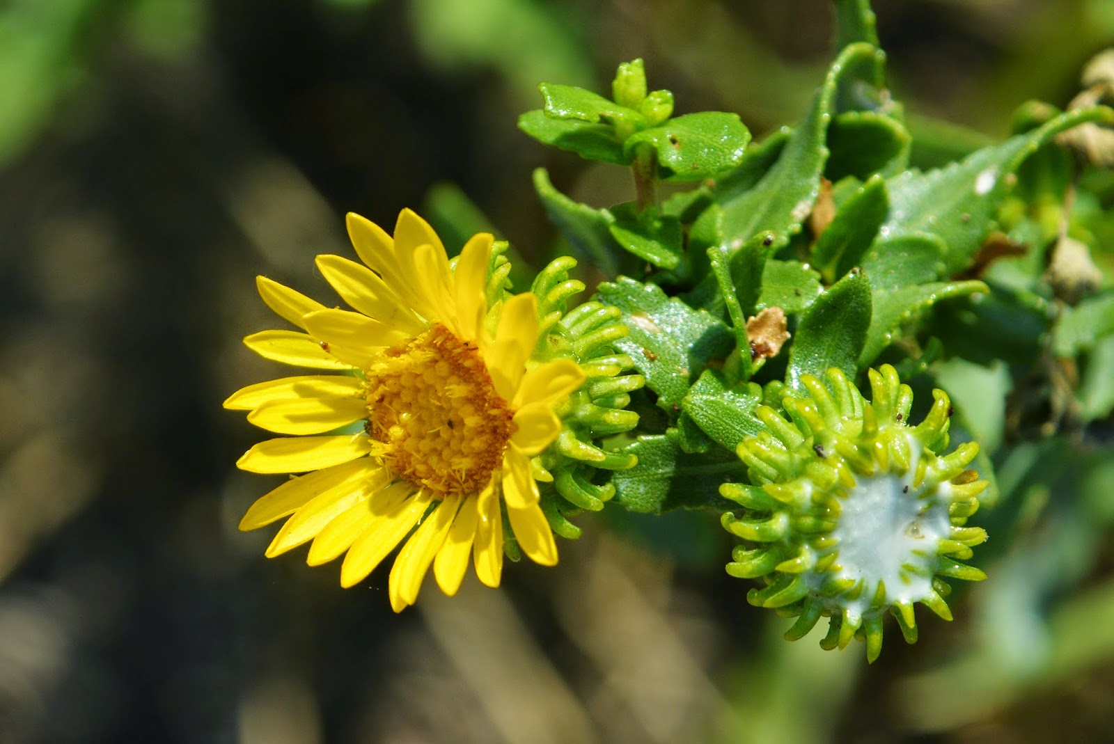
Please excuse me, but I couldn't resist taking just a few photographs of what I call
VISIONS OF NATURE.

Aren't these VISONS WONDERFUL?
Get closer to them...or zoom in and you'll see what I mean.

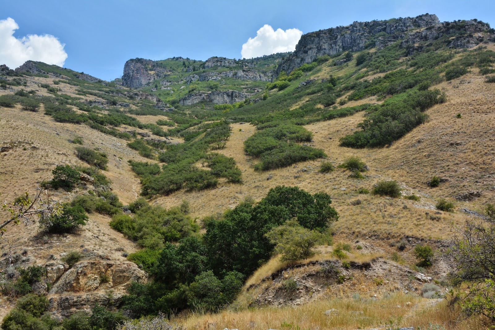
At the bottom of Slide Canyon we get our first glimpse of the pathway coming down the south side of the steep canyon.

The arrow is pointing at a large half-moon area above the pathway, for who knows what purpose? You see it below on Google Earth which is a flattened view that gives no idea just how steep a mountain and pathway we are dealing with and the half moon almost vertical.


Here we zoom in on the nearly vertical half moon cleared area. soon I'll be up there for some close-ups.


More magnificent VISIONS!
For me every time wonderful testimonies of our Creator's kind hand!

50 yards or so off the foothill road--or BONNEVILE SHORELINE TRAIL, I begin following the pathway, first hitting my SPOT Tracker OK button.

The pathway disappeared into the scrub oak, tunneling through.


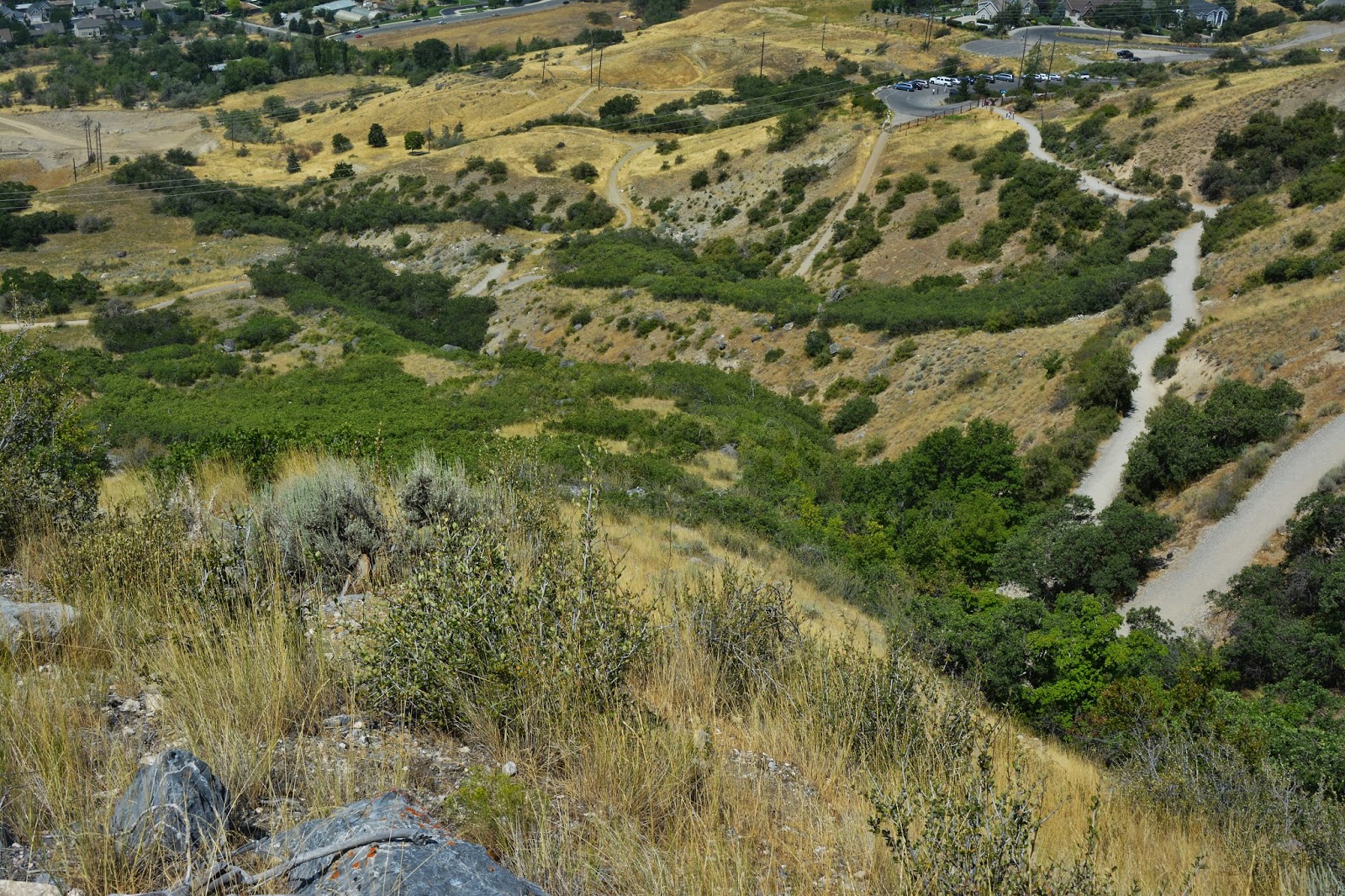
To keep us oriented as to where we are I'll take photos from each spot looking back down, seeing here the eastern edge of Provo. From this point the pathway goes straight down and seems to end at the foothill road, which the Bonneville Shoreline Trail follows.

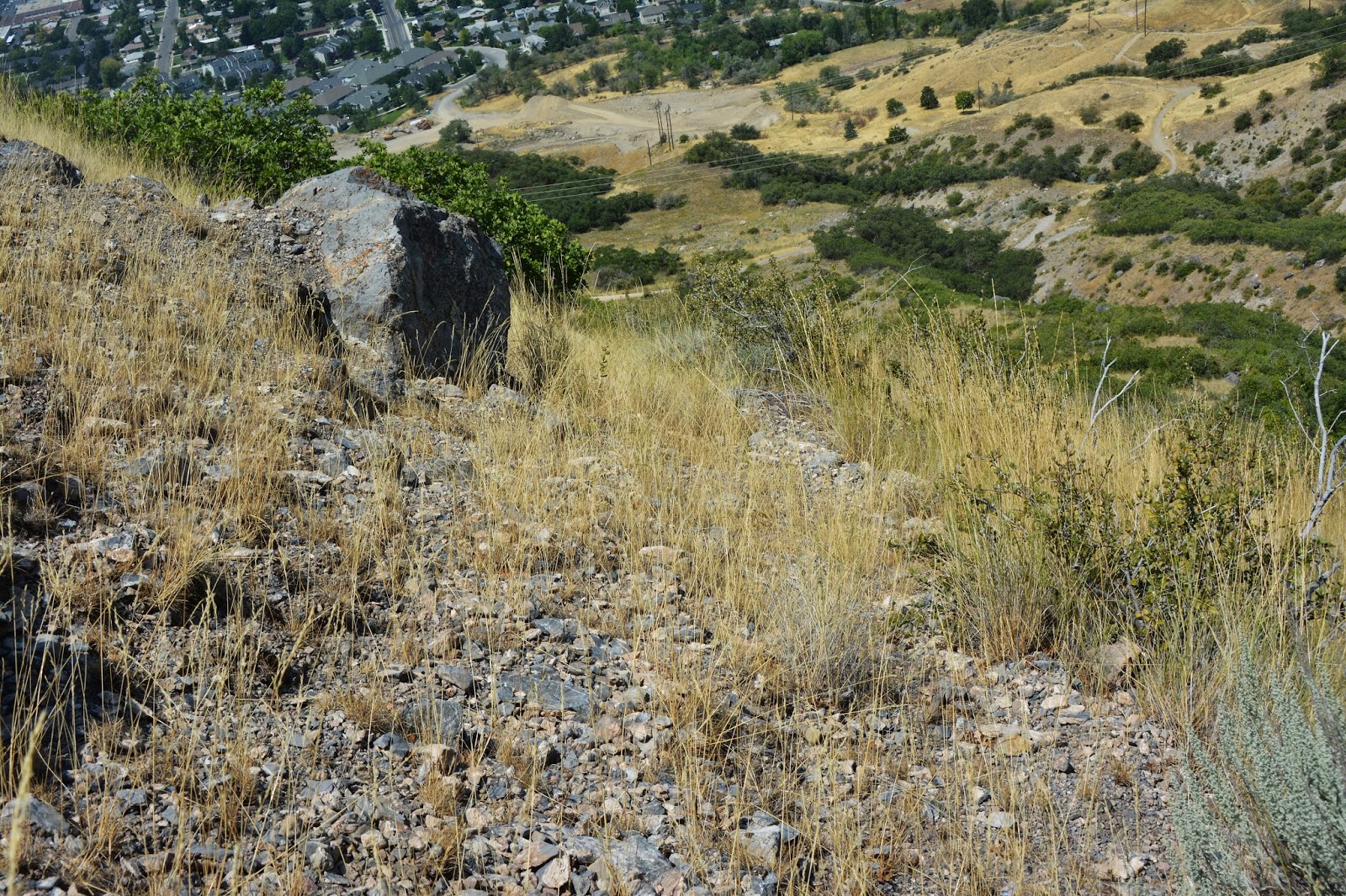
The steepness and roughness of the area can't really be appreciated in these photos. Often I was scratching and clawing my way up the pathway.
.JPG)
At this point a trail crossed the pathway. Sometimes the trail followed the pathway, but usually zigg-zagged up the mountain, and was much easier to hike than the much steeper pathway that followed a more direct route up the mountain..


Here we get our first glimpse of hikers on the Y-Trail. Soon the pathway will take us up above the first turn of that trail.

We continue up the pathway, not finding any kind of wood artifacts, much less square nails. Usually it was quite wide as we see here...at least 2 to 3 yards. Below looking back down from the same point.


We are now above the first turn on the Y-Trail. I hit the SPOT OK button, but apparently was too impatient, so it didn't register, but the spot was basically as indicated below by the arrow, at the lower part of that area with a wide half moon cleared above the pathway--in very steep country.


Here we see the pathway continuing up the canyon.

The half-moon cleared area (of scrub oak) is very steep and covered by tall grass and dry underbrush as seen below.


This is the view looking straight down from the same spot.......
.....and here moving over just a bit to show both the pathway and the Y-Trail

Zooming in on the Y hikers.
This was the highest point of my exploration looking down, and with the Google Earth view below, showing the SPOT Tracker OK symbol.


Here we are looking up towards Eagle Pass.
I found no remnants or artifacts that most assuredly would have been there if they had of actually built a flume-like timber slide.


In this view looking up at Eagle Pass, we can see glimpses of the pathway from the bottom center, up through te middle of the photograph. The pathway continues up in very steep, rough terrain.


I'm now on a game trail zigg-zagging up to the top of the ridge leading to the face of the mountain. Above we can see the pathway of the slide angling across the picture.

I have now come around to the face of the mountain and head down what was such a steep mountain that for the first time in my life I found a stout staff to steady me and brake my descent as I scrambled down.
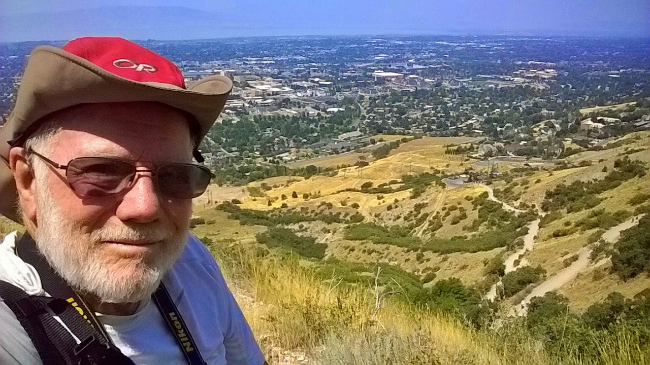
I might mention that during my COMEBACK efforts in 2012, of which I made a whole series of YouTube videos, finally resolving to be a cripple--before giving the doctors another chance or two, I could have never climbed up here, nor made it back down in one piece.
HOW GRATEFUL I AM FOR WHAT SEEMS LIKE A MIRACULOUS "2nd CHANCE" TO KEEP MOVING!.

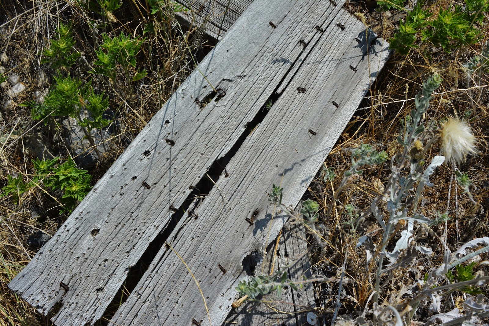
Down near the bottom I excitedly found some old pieces of wood and examined them
.

But soon noticed round nails, which were invented in 1910, so I was looking at something that had nothing to do with the pioneers.

At about the point where the prints I had of Google Earth with me had the pathway coming down the face of the mountain to the road, I came to this gate, and it was there I hit the SPOT Tracker OK bottom, took a rest and drank some ice water, and then got in position to photograph what I could distinguish as the pathway of the flume--actually seen in the photo below directly over my right shoulder..

I had got enough good exercise for one day, so will wait until next week to follow this pathway just as far as I can......and report.
I could see the pathway coming right down through the center of the photograph, pinpointed below in the Google Earth view. Eventually I got an angle where it is more visible....seen a few pictures below.

My SPOT Tracker OK signal is seen above, as is the pathway in this Google Earth view below.

It is also quite visible in this Fall photograph and the close-up seen below.

This close-up of the pathway actually seems like a created shallow trench in the lower portion. For this I found a historical reference I will quote in my next report when I will hike up the pathway as far as I can.

From this angle I was able to see it quite well.

Zooming in up high I could barely see it, but it's there as we can see on Google Earth seen below from up high where it begins in the upper right corner.

So, I headed back to the car calling it a day.....except for this beautiful little guy I photographed along the way.


NO, he doesn't have mumps, but was making trips back and forth to his den loading up on acorns


RESULTS SO FAR: FRUSTRATION?
ASSUMPTIONS, perhaps wrong influenced by tie hacker's "FLUMES"
I envisioned the following, but without the water, rather gravity carrying the timber on a REALLY WILD RIDE down to the valley & been looking for remnants of such...NOTHING FOUND SO FAR.
So, HOW DID THE PIONEER TIMBER SLIDES WORK?
I'll be doing more research in trying to figure it out. Do any of you have any ideas? Let me know what you think.
NOTE: In my research I just found some important historical references on the timber slides first constructed in "1853," including the first one in an area a little further south which I have pictured in COMEBACK videos and described as "a trail." These exciting pioneer descriptions of the timber slides will be included in the report of my next exploration which will be to follow the pathway up the face of the mountain which the pioneers described as "Slide Mountain!"
Hi Cordell,
ReplyDeleteAs a kid, we used to explore a couple of "log slides" (the name we learned from our parents for these huge scars on the mountain) in southeast Salt Lake County. The log slides are located on some scary, steep mountainsides.
We always figured that the pioneers used gravity wherever they could to get logs down and then hooked them to horses or mules to drag them out to wagons. Don't know if this assumption is accurate or not, but I can only imagine how terribly difficult the job of harvesting and getting logs off those steep mountainsides must have been.
I'll be very curious to see what else you discover about these log or timer slides. Good work!
Dean Mitchell
Thanks, DEAN, as I mentioned in my last email, I have found some references that I will share in the report of my next exploration. Take care, your buddy, CORDELL
Delete